40 Times Earth’s Geography Looked Too Mind-Blowing To Be Real
The natural world is a place of endless fascination, an ever-changing canvas of terrain, weather, flora, fauna, and human history woven into the landscape. If you ever need a reminder of how vast, strange, beautiful, and sometimes downright surreal our planet is, the subreddit r/Geography has you covered.
With nearly two million members, the community is dedicated to sharing everything from incredible satellite images and strange geological formations to snapshots of rare weather events, strange abandoned places, and cultural quirks tied to geography. What you’ll find there isn’t just about maps or textbooks; it’s about experiencing Earth in ways that will make you pause and appreciate the planet we live on.
Here are some of the most breathtaking and wildly fascinating photos shared by geography lovers that highlight just how magical and bizarre Earth can be.
#1 While I Was On The Highway I Witnessed The Eruption Of Etna Live... It Was Exciting
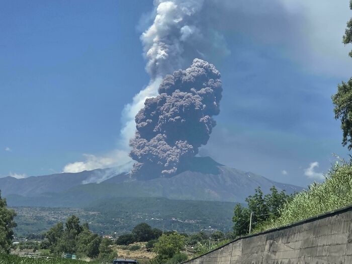 Image source: xDavid83x
#2 LA Is A Wasted Opportunity
Imagine if Los Angeles was built like Barcelona. Dense 15 million people metropolis with great public transportation and walkability. They wasted this perfect climate and perfect place for city by building a endless suburban sprawl.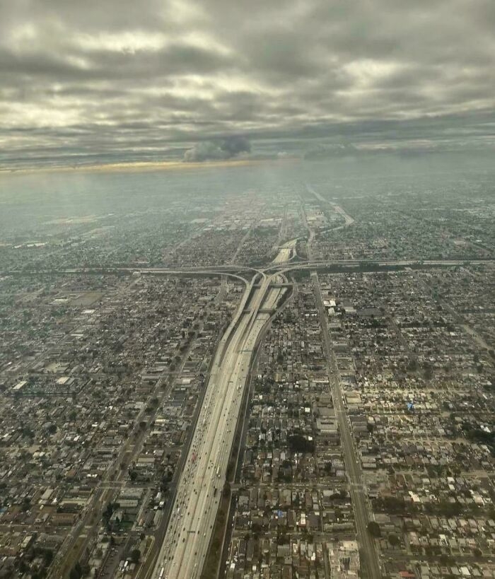 Image source: villehhulkkonen
#3 Canada Still Has 91% Of The Forest Cover That Existed At The Beginning Of The European Settlement
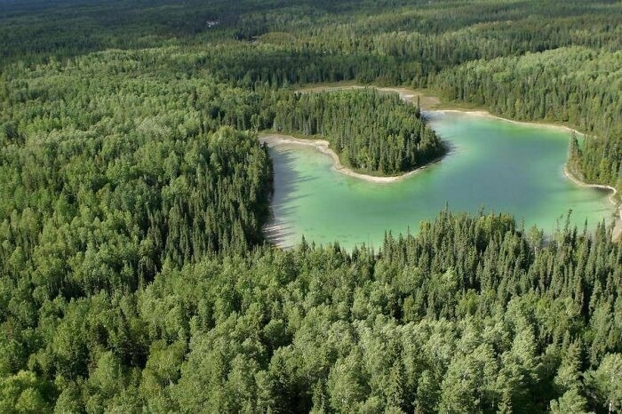 Image source: WdrFgt
#4 I Went To An Unknown (For Me) Island 2 Hours From Home And Mapped It From Scratch With A Compass And A Rangefinder!
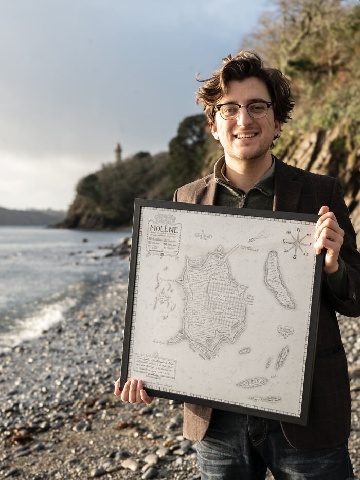 Image source: mydriase
#5 The Sahara Desert After Heavy Rain In Morocco
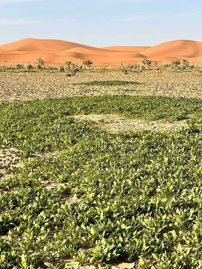 Image source: Specific-Minimum-185
#6 Friendly Reminder Of Just How Ridiculously Big The Pacific Ocean Is
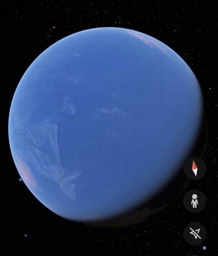 Image source: Thin-Pool-8025
#7 Thought This Sub Would Appreciate A Window Seat Picture Of The Maldives
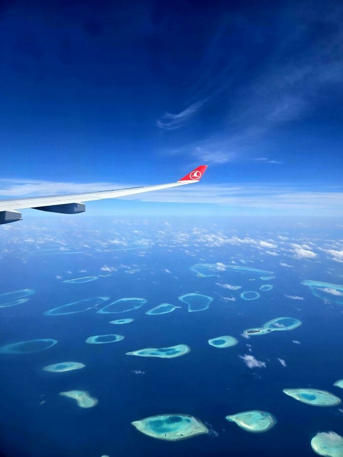 Image source: freecodeio
#8 Mt. Fuji From The ISS
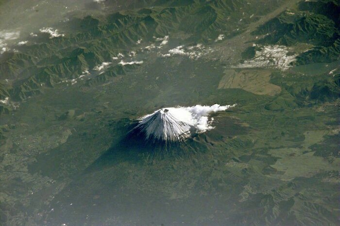 Image source: ZannaSmanna
#9 Fun Fact I Found On A Snapple Cap
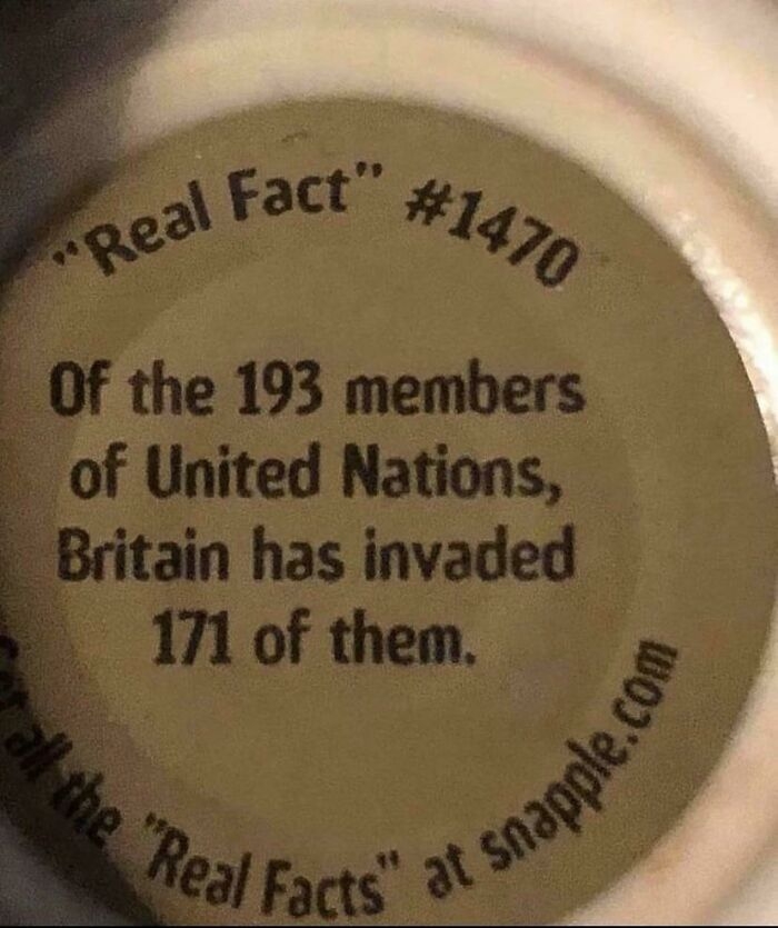 Image source: Nfl-nbA
#10 The Scottish Highlands, The Appalachians, And The Atlas Are The Same Mountain Range, Once Connected As The Central Pangean Mountains
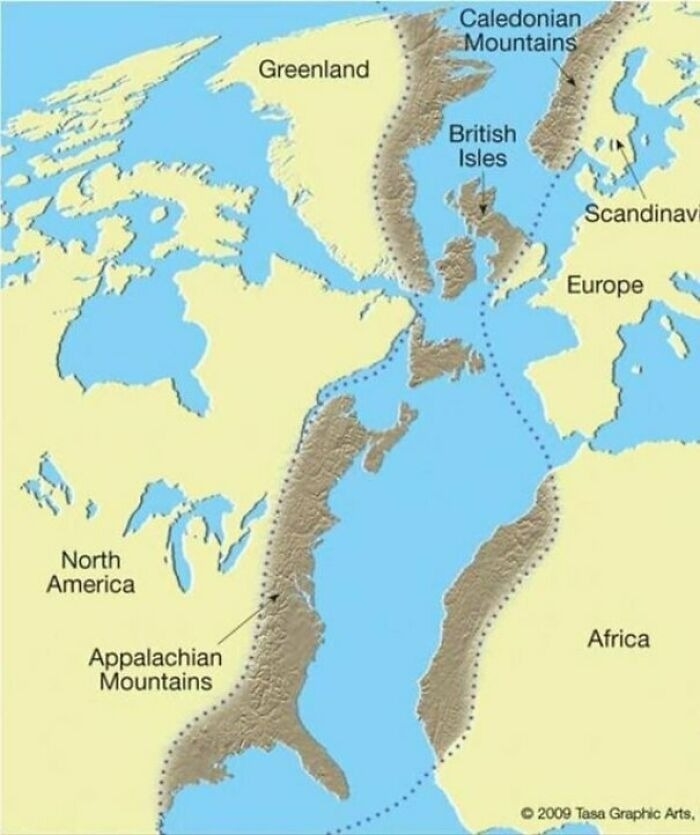 Image source: reddit.com
#11 Devil's Tower, Wyoming. A Large Butte, It Reaches 5112 Feet Above Sea Level
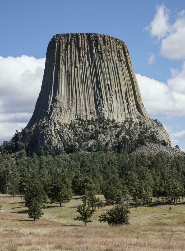 Image source: Jonnyboo234
#12 Topography Of The Indian Subcontinent
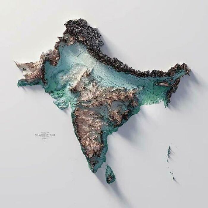 Image source: KingLeopldII
#13 Tracking Of An Eagle Over A 20 Year Period
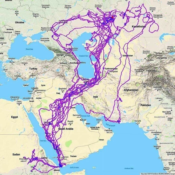 Image source: HDeo950
#14 There's A Lake In Finland That Looks Like Finland!
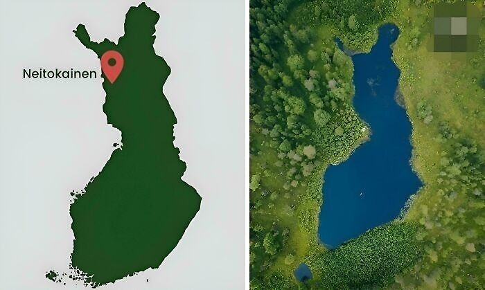 Image source: Master1_4Disaster
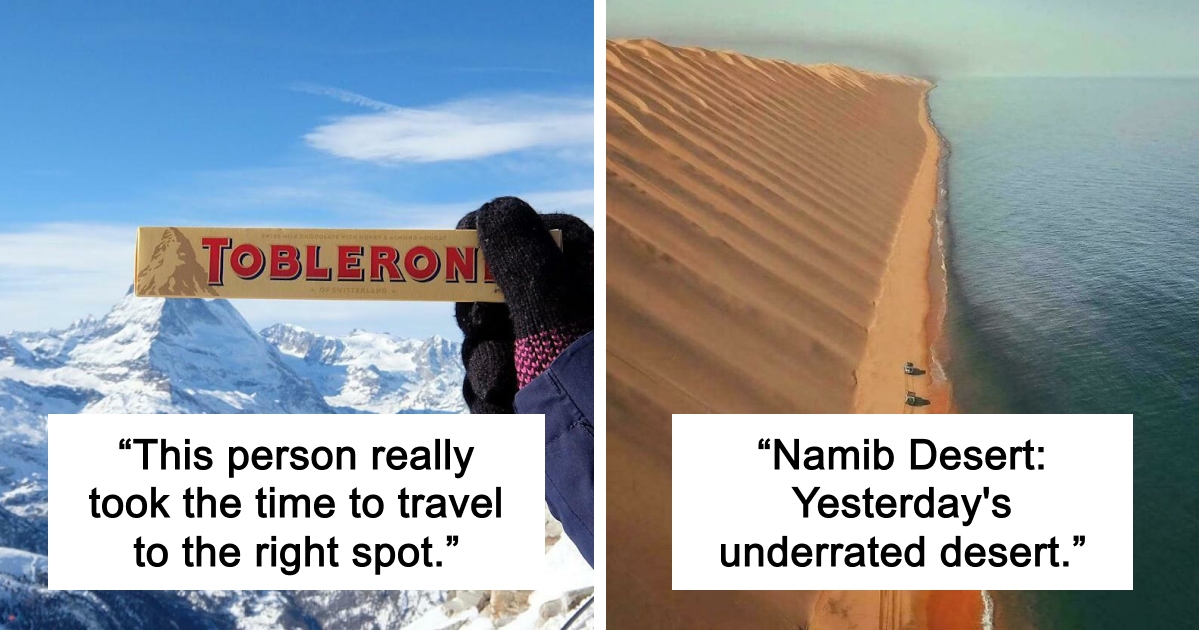
#15 This Person Really Took The Time To Travel To The Right Spot
 Image source: kajola1969
#16 A Modern Photo Compared With A Photo Taken Over A Century Earlier In The Same Place
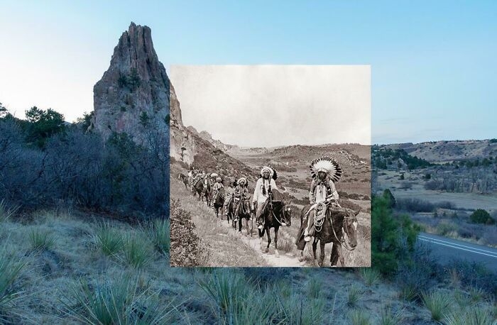 Image source: birdyroger
#17 The Parking Lot By My House Has Been Flooded Long Enough For Google Maps To Recognize It As The Natural Wonder That It Is
 Image source: kingbob123456
#18 Namib Desert: Yesterday’s Underrated Desert
Fog is the primary source of water in the site, accounting for a unique environment in which endemic invertebrates, reptiles and mammals adapt to an ever-changing variety of microhabitats and ecological niches.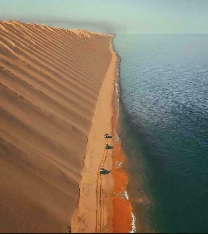 Image source: mabaezd
#19 [Close-Up View] Of Antarctica From Space
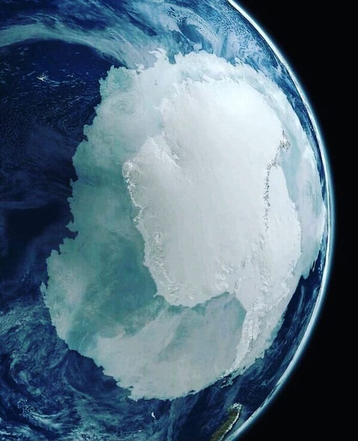 Image source: reinascythe7
#20 Look At This Curiosity!
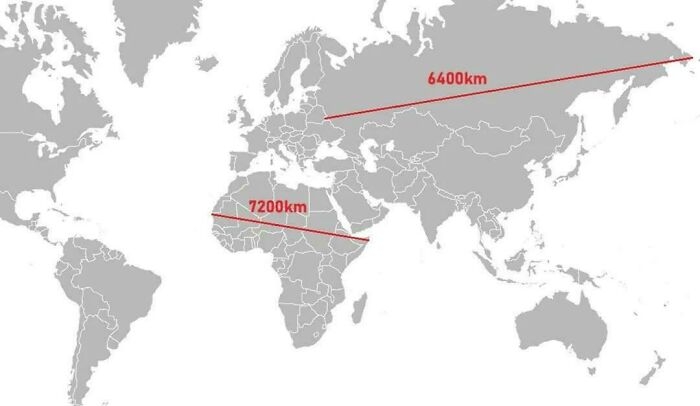 Image source: CzarEDII
#21 50 Percent Of Canadians Live South Of The Red Line
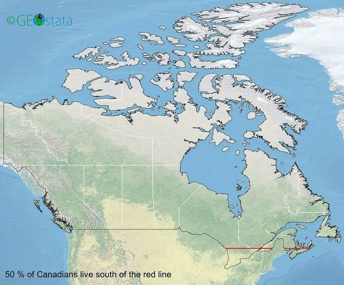 Image source: Outlaw_Genitals
#22 Fun Fact About Patagonia That Most People Don't Know: 90% Of It Looks Like This
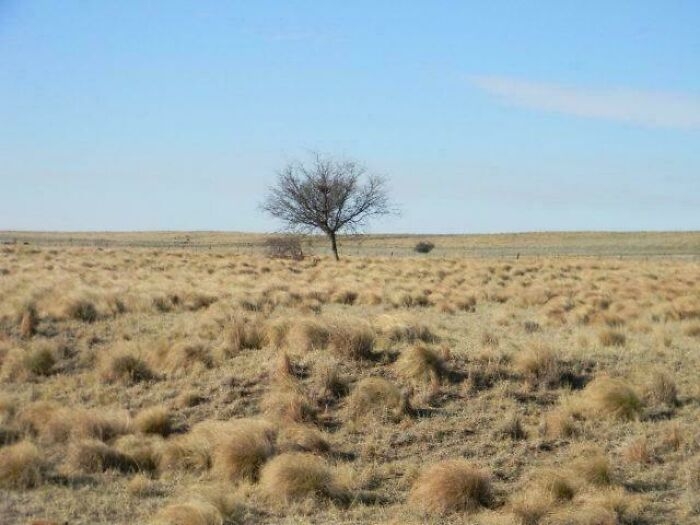 Image source: spait09
#23 Bro Why Not Use The Metric System?
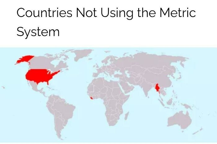 Image source: Master1_4Disaster
#24 How Antarctica Would Look If All The Ice Melted
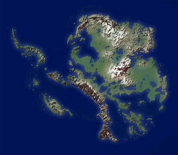 Image source: Geo-ICT
#25 No Hurricane Has Ever Crossed The Equator
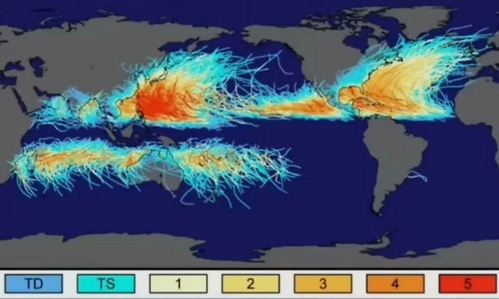 Image source: Hockputer09
#26 Huge Landslide Causes Whole Village To Disappear In Switzerland
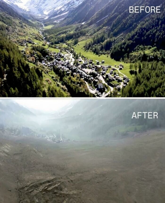 Image source: BalanceNo1216
#27 Europe Used To Look Like This!
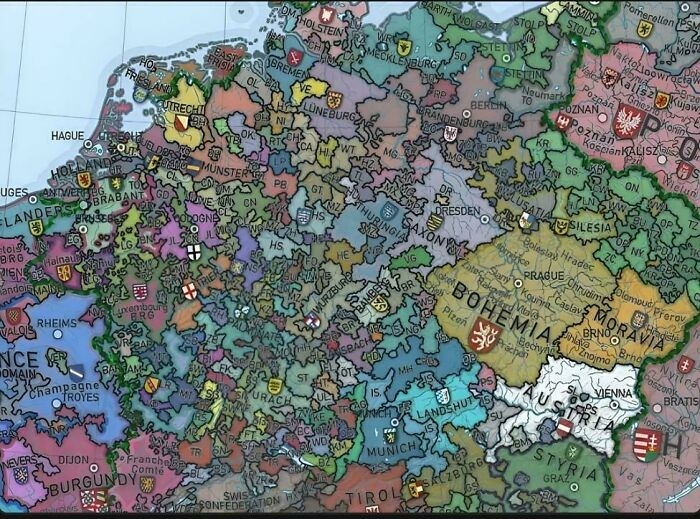 Image source: Master1_4Disaster
#28 Madagascar Is Way Bigger Than I Thought
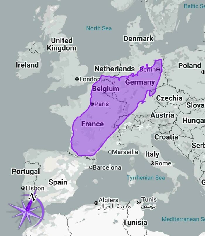 Image source: LordLorkhan
#29 Chances Of Being Born In Each Continent
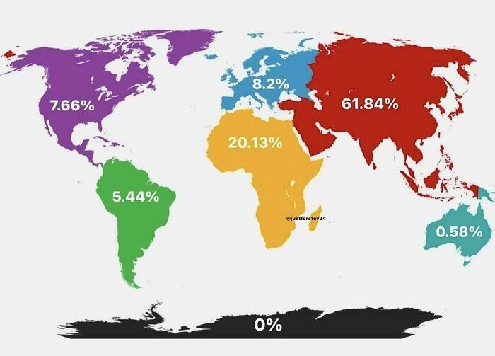 Image source: timroAlabamasis
#30 A Map Of Nations When Asked The Question "Which Country Is The Largest Threat To World Peace?" - In 2013
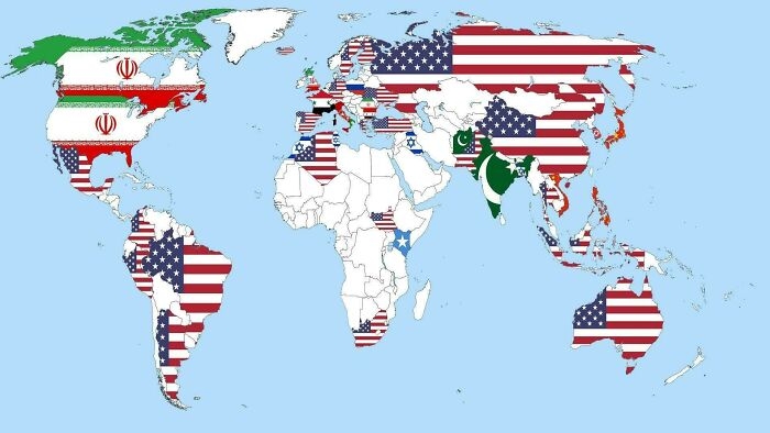 Image source: history-remaster
#31 Cross Sea Is A Very Beautiful And Rare Phenomenon That Happens When There Are 2 Wave Systems In The Sea Moving At Oblique Angles
It might be beautiful from above, but if you get caught in these waves, your vessel can easily turn upside down or lose its way.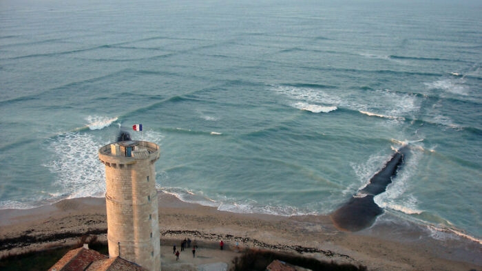 Image source: JesseBBrown
#32 Every Territory England, Great Britain, And The UK Ever Controlled
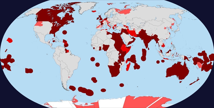 Image source: bluesheepreasoning
#33 I Feel As If Someone Just Got Bored Of Naming Things Here
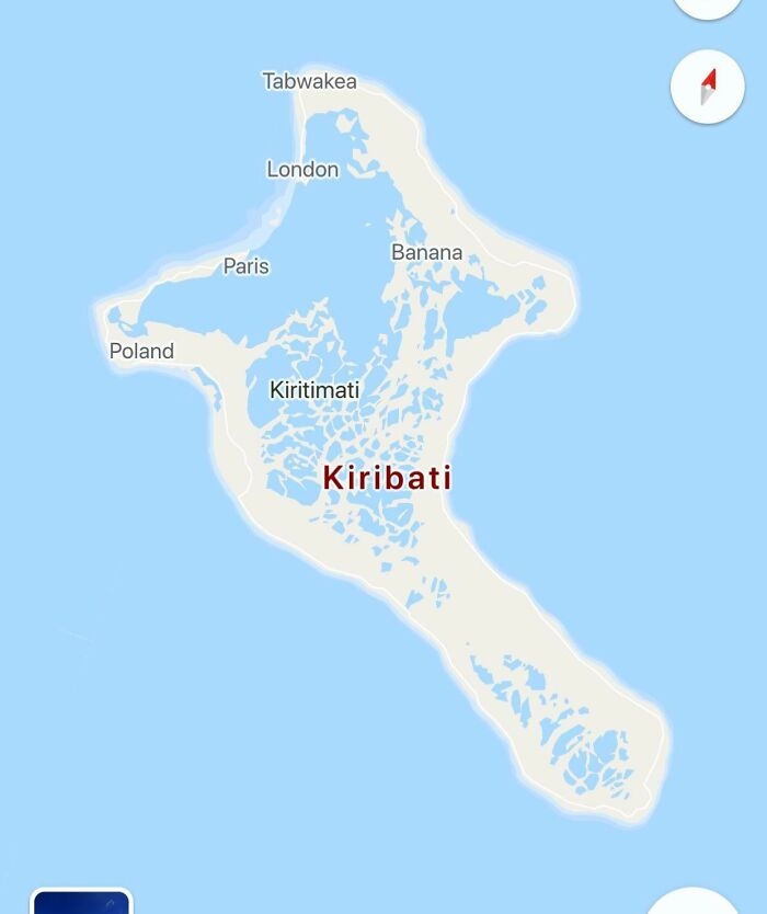 Image source: TastyMiscarriageSmeg
#34 Countries With State Religion
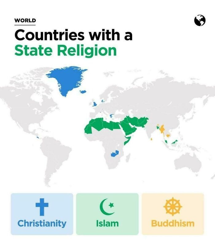 Image source: Ill_Tonight6349
#35 The Roman Empire Administrative Divisions In 395 Ad
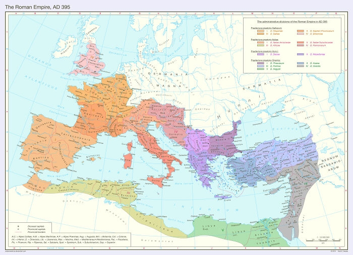 Image source: M-Rayusa
#36 Asia (And Surrounding Areas) In 1444
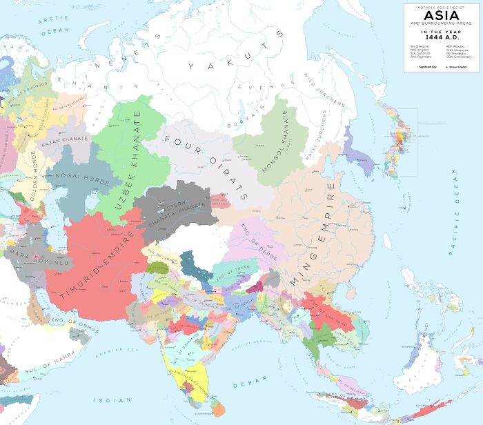 Image source: girthynarwhal
#37 Mean Age Of Women At Birth Of First Child
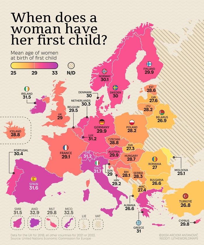 Image source: theworldmaps
#38 Estonia Is The Northernmost Country In The World With No Part Of It Being In The Arctic
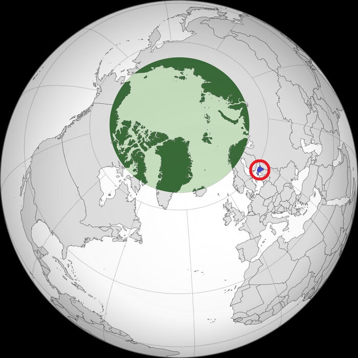 Image source: Double-decker_trams
#39 All Cities In The World
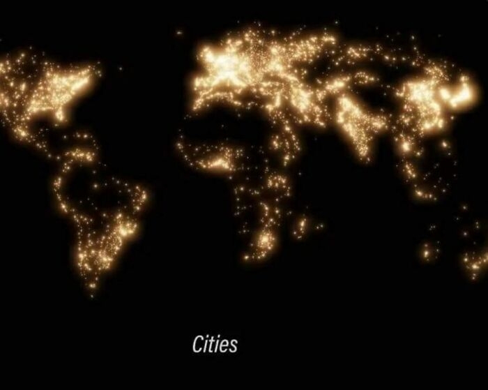 Image source: Master1_4Disaster
#40 Never Knew These Big American Cities Were So Close Together
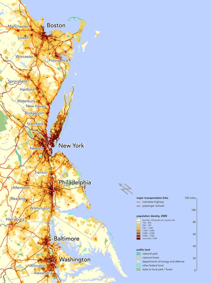 Image source: Smoke_Me_When_i_Die
With 5+ years in the creator, entertainment, and publishing spaces, Demilked shortlists, reviews, and ranks leading tools that actually make your life easier.