Geologist Who ‘Travels’ In Google Maps Shares His 50 Most Interesting Finds
In today's modern society, navigating without Google Maps is unimaginable. In fact, some people enjoy spending their time walking on Google Maps in their free time and checking most random places from all around the world. One man that goes under the nickname geologistmakesthebedrock has started screenshotting his most unique finds on Google Maps, and some are incredibly interesting.
Independently testedUnbiased Demilked scoreFree to implementTools included
In today's modern society, navigating without Google Maps is unimaginable. In fact, some people enjoy spending their time walking on Google Maps in their free time and checking most random places from all around the world. One man that goes under the nickname geologistmakesthebedrock has started screenshotting his most unique finds on Google Maps, and some are incredibly interesting. In an interview with Bored Panda the man explained how he started collecting these images, "I tried to find interesting examples of geologic processes to use in lecture presentations. That’s when I started gathering screen shots of cool stuff for myself. Then I decided to share some images on Imgur because my wife was tired of me making her look at them and listen to my explanations."
Most of these findings include various land formations as well as man-made structures, and what makes these images even more interesting is short commentary this geologist adds under the photos while trying to explain what he has found.
Scroll down to check these cool findings yourself, and don't forget to tell us what you think in the comments!
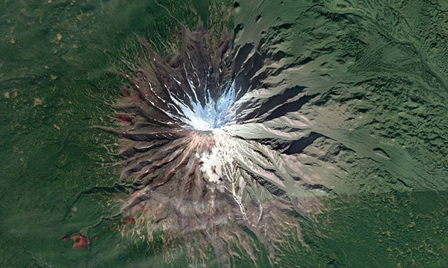
 "A beautifully symmetrical volcano on the Kamchatka Peninsula in Russia. Look at those weird red cinder cones on the flanks."
Image source: imgur.com
"A beautifully symmetrical volcano on the Kamchatka Peninsula in Russia. Look at those weird red cinder cones on the flanks."
Image source: imgur.com
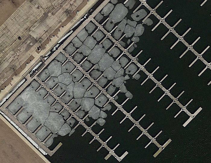 "This is my favorite. It's a marina near Milwaukee, Wisconsin (USA). The winter ice is in the process of breaking up. I don't know why, but this is very visually appealing to me."
Image source: imgur.com
"This is my favorite. It's a marina near Milwaukee, Wisconsin (USA). The winter ice is in the process of breaking up. I don't know why, but this is very visually appealing to me."
Image source: imgur.com
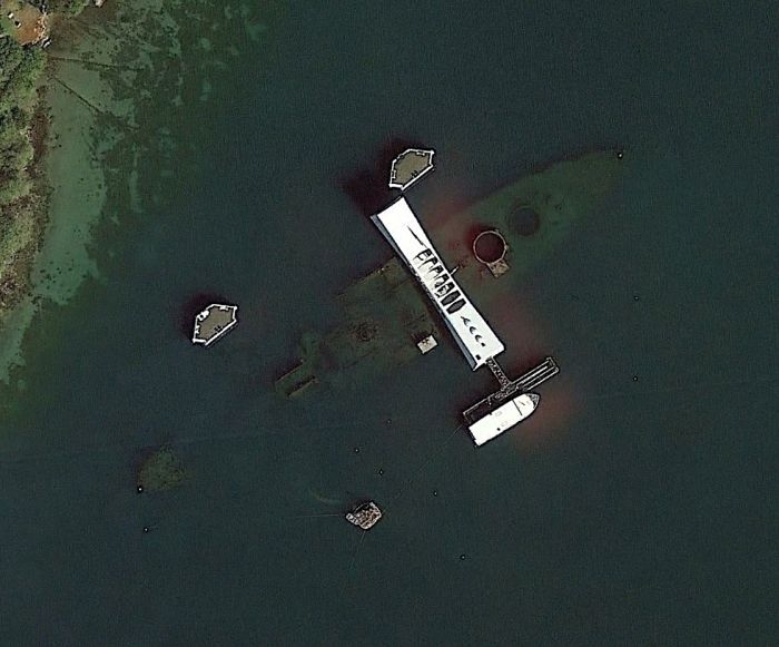 "USS Arizona and memorial, Pearl Harbor."
Image source: imgur.com
"USS Arizona and memorial, Pearl Harbor."
Image source: imgur.com
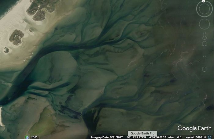 "Underwater tidal channels of the Wadden Sea of Denmark."
Image source: imgur.com
"Underwater tidal channels of the Wadden Sea of Denmark."
Image source: imgur.com
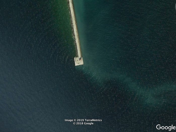 "A breakwater and lighthouse on one of the Great Lakes. I can't remember where. Notice the circular pattern of waves reflecting off the structure."
Image source: imgur.com
"A breakwater and lighthouse on one of the Great Lakes. I can't remember where. Notice the circular pattern of waves reflecting off the structure."
Image source: imgur.com
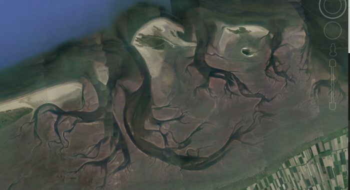 "Still the Wadden Sea. Look at that tidal current rippin through there. This one is spooky."
Image source: imgur.com
"Still the Wadden Sea. Look at that tidal current rippin through there. This one is spooky."
Image source: imgur.com
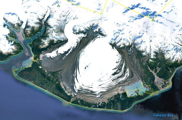 "Alpine glaciers spilling out spreading across a flat plain. This is in SE Alaska."
Image source: imgur.com
"Alpine glaciers spilling out spreading across a flat plain. This is in SE Alaska."
Image source: imgur.com
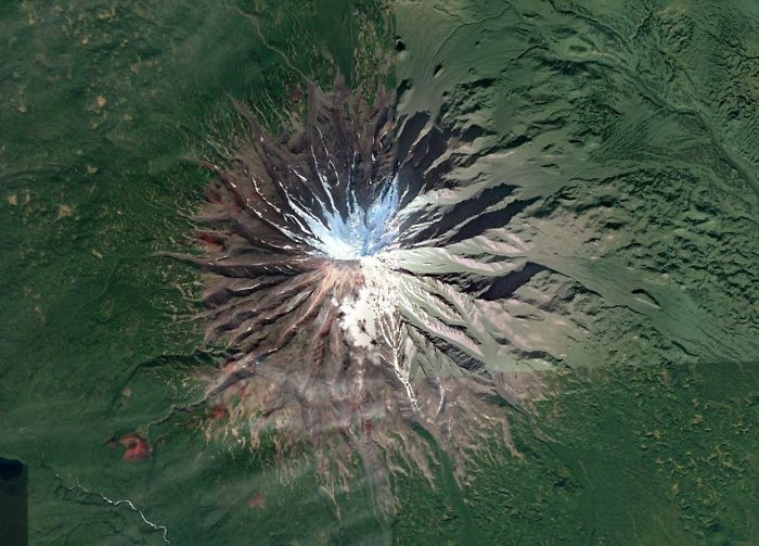
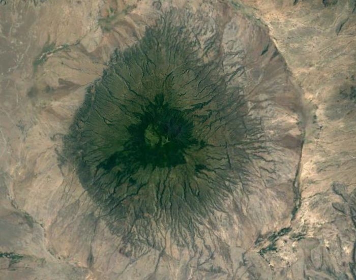 "A volcano in the Great Rift Valley in Tanzania. It's tall enough to have its own, wetter micro climate, hence the green."
Image source: imgur.com
"A volcano in the Great Rift Valley in Tanzania. It's tall enough to have its own, wetter micro climate, hence the green."
Image source: imgur.com
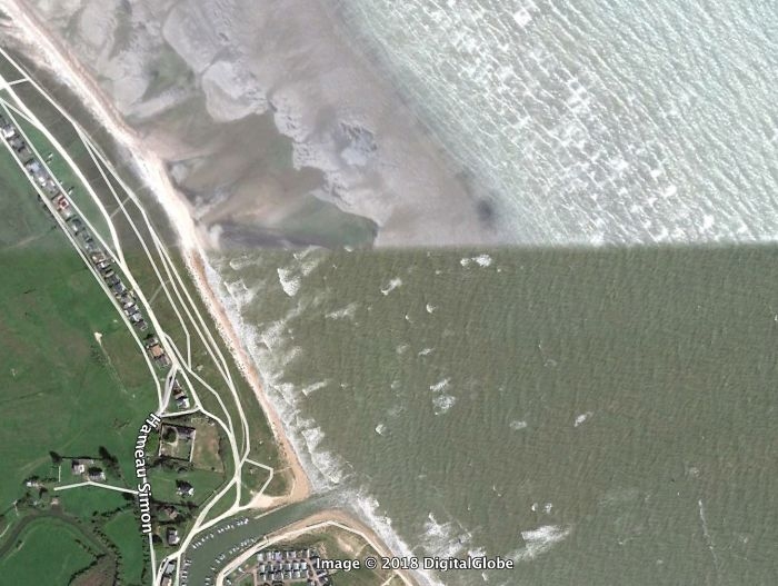 "High vs. low tide on a Normandy beach."
Image source: imgur.com
"High vs. low tide on a Normandy beach."
Image source: imgur.com
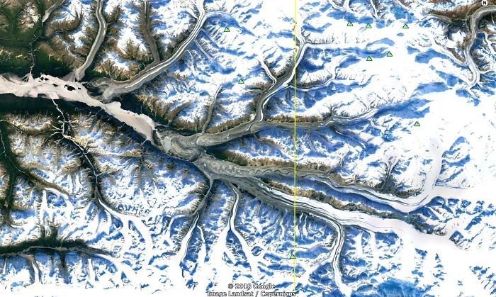 "SE Alaska, multiple alpine glaciers flowing together."
Image source: imgur.com
"SE Alaska, multiple alpine glaciers flowing together."
Image source: imgur.com
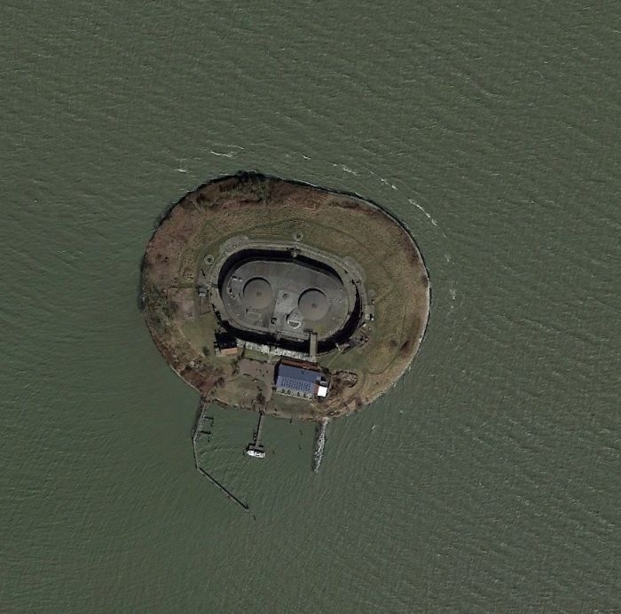 "A lonely little gun emplacement that used to guard the entrance to Amsterdam. "
Image source: imgur.com
"A lonely little gun emplacement that used to guard the entrance to Amsterdam. "
Image source: imgur.com
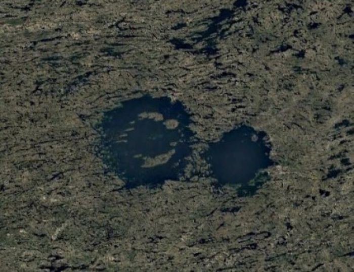 "These are impact craters in the Canadian Shield, the oldest continental crust of the North American plate. Because it’s been tectonically inactive for a long time and continental glaciers removed most of the topsoil, many craters are visible. This lake is called Lac a l’Eau Claire. There is a lot of evidence that the lake is formed by 2 impact craters. It was originally thought that the 2 impacts were formed at the same time by an asteroid that split or was a binary asteroid. There is some very compelling evidence that these are 2 different impacts, ~200 million years apart. It might seem like a million to one shot that 2 impacts could be so close, but we see many overlapping craters on other planets. The low probability thing for me is that the craters were both preserved and exposed."
Image source: imgur.com
"These are impact craters in the Canadian Shield, the oldest continental crust of the North American plate. Because it’s been tectonically inactive for a long time and continental glaciers removed most of the topsoil, many craters are visible. This lake is called Lac a l’Eau Claire. There is a lot of evidence that the lake is formed by 2 impact craters. It was originally thought that the 2 impacts were formed at the same time by an asteroid that split or was a binary asteroid. There is some very compelling evidence that these are 2 different impacts, ~200 million years apart. It might seem like a million to one shot that 2 impacts could be so close, but we see many overlapping craters on other planets. The low probability thing for me is that the craters were both preserved and exposed."
Image source: imgur.com
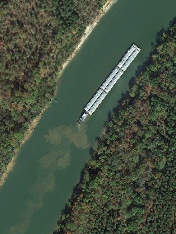 "A push boat and barges stirring up the bottom of the Tombigbee River in Alabama (USA)."
Image source: imgur.com
"A push boat and barges stirring up the bottom of the Tombigbee River in Alabama (USA)."
Image source: imgur.com
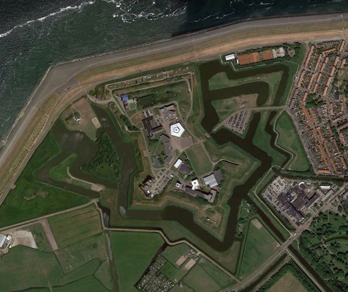 "A fort in the Netherlands."
Image source: imgur.com
"A fort in the Netherlands."
Image source: imgur.com
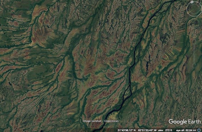
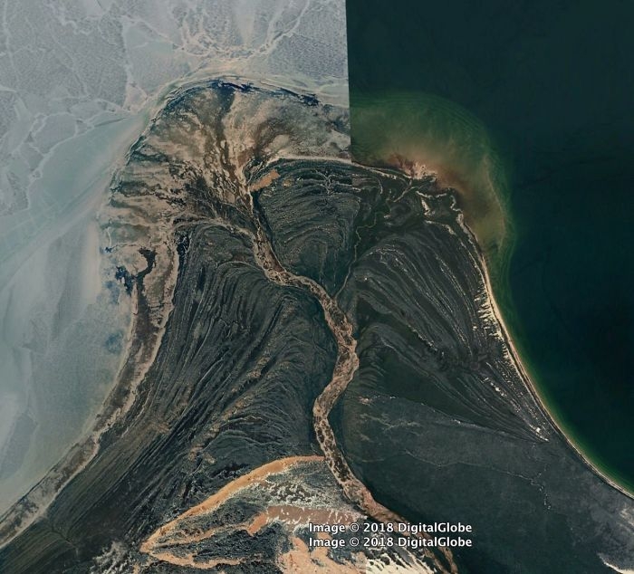 "Above is the coolest delta I've ever seen. It's formed by the William River, which flows through Athabasca Sand Dunes Provincial Park and into Lake Athabasca, Saskatchewan CA. This river has recently become my favorite river, because we share a name. The left side of the image seems to be while the lake is frozen but the river is not. The bands that sort of parallel the shoreline look like cheniers."
Image source: imgur.com
"Above is the coolest delta I've ever seen. It's formed by the William River, which flows through Athabasca Sand Dunes Provincial Park and into Lake Athabasca, Saskatchewan CA. This river has recently become my favorite river, because we share a name. The left side of the image seems to be while the lake is frozen but the river is not. The bands that sort of parallel the shoreline look like cheniers."
Image source: imgur.com
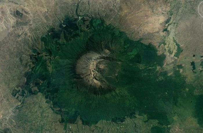 "Another volcano in the Great Rift Valley with a micro climate and a very asymmetrical crater, much like Mt. St. Helens."
Image source: imgur.com
"Another volcano in the Great Rift Valley with a micro climate and a very asymmetrical crater, much like Mt. St. Helens."
Image source: imgur.com
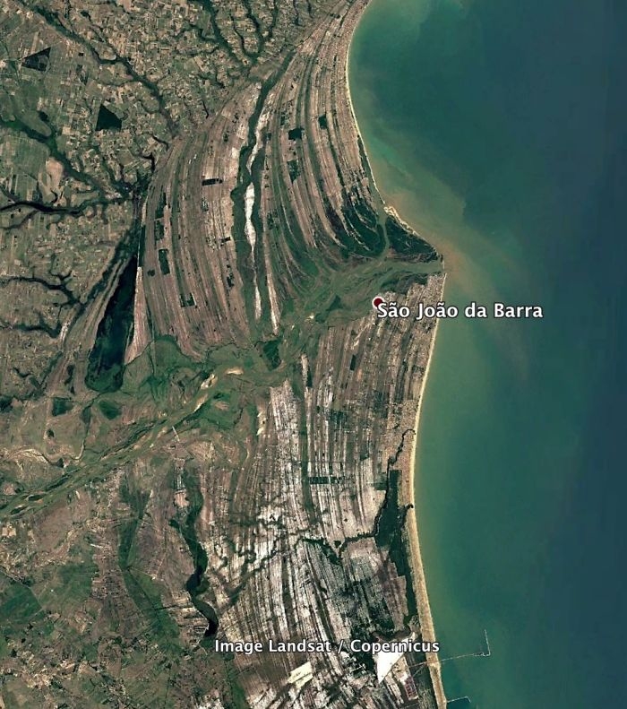 "A beautiful wave-dominated delta in Brazil."
Image source: imgur.com
"A beautiful wave-dominated delta in Brazil."
Image source: imgur.com
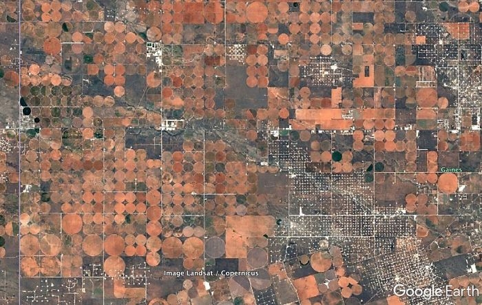 "Irrigated fields in west Texas. The colors here are awesome. I'm guessing the crops were recently harvested or recently plowed under and we're seeing the soil color. In my experience, harvested corn or wheat fields aren't this orange/red. Any ideas? The white specks are oil pads connected by little roads. This land is certainly being utilized."
Image source: imgur.com
"Irrigated fields in west Texas. The colors here are awesome. I'm guessing the crops were recently harvested or recently plowed under and we're seeing the soil color. In my experience, harvested corn or wheat fields aren't this orange/red. Any ideas? The white specks are oil pads connected by little roads. This land is certainly being utilized."
Image source: imgur.com
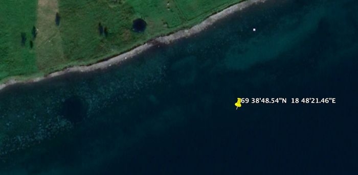 "I read about this one on a forum. I think it's true. The GPS point is the location of the German battleship, Tirpitz when it was sunk by British bombers on 11/12/1944. The Tirpitz was the sister ship of the famous Bismarck. It was also the last serious German surface naval threat. The RAF and Royal Navy played a long cat and mouse game with the Tirpitz as it hid out in Norwegian fjords. It was eventually located and Lancaster bombers attached at high altitude with huge bombs. The 3 round holes (2 in the water, 1 on land) are likely craters from missed bombs. They don't make sense geologically"
Image source: imgur.com
"I read about this one on a forum. I think it's true. The GPS point is the location of the German battleship, Tirpitz when it was sunk by British bombers on 11/12/1944. The Tirpitz was the sister ship of the famous Bismarck. It was also the last serious German surface naval threat. The RAF and Royal Navy played a long cat and mouse game with the Tirpitz as it hid out in Norwegian fjords. It was eventually located and Lancaster bombers attached at high altitude with huge bombs. The 3 round holes (2 in the water, 1 on land) are likely craters from missed bombs. They don't make sense geologically"
Image source: imgur.com
 "This is a random place in the Ontario, CA. I think the colors are very nice."
Image source: imgur.com
"This is a random place in the Ontario, CA. I think the colors are very nice."
Image source: imgur.com
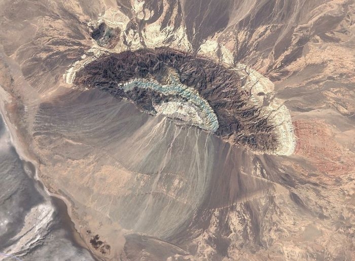 "An anticline somewhere in Iran with a series of alluvial fans on the south side. I really like the blue color of the formation ringing the center of the anticline. I need to go there and get a sample. You can see the colors of the formations reflected in the fan."
Image source: imgur.com
"An anticline somewhere in Iran with a series of alluvial fans on the south side. I really like the blue color of the formation ringing the center of the anticline. I need to go there and get a sample. You can see the colors of the formations reflected in the fan."
Image source: imgur.com
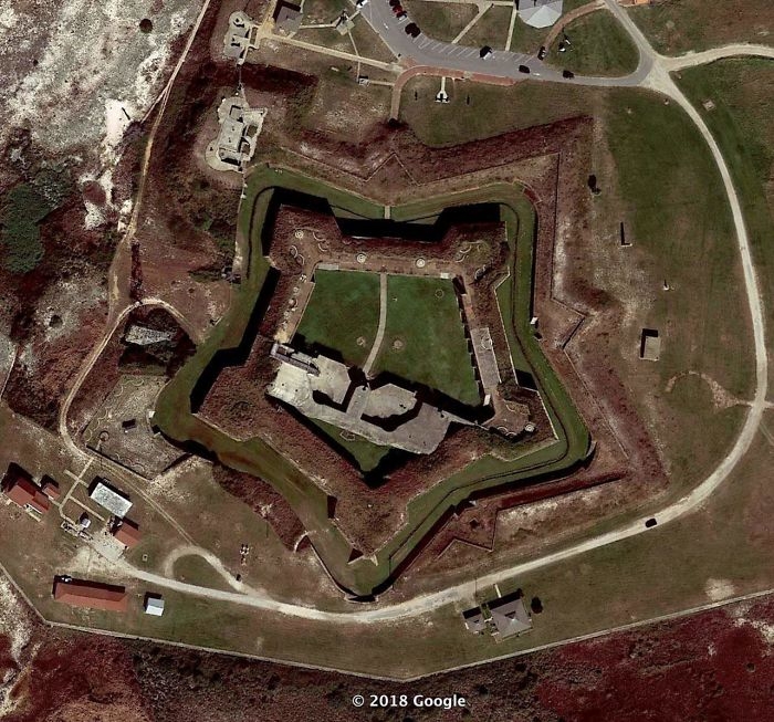 "After the pretty bad performance of the US in the war of 1812, the federal government realized some things. They needed to maintain a larger, federally controlled, standing army. The states militias were just not up to the task when it came to real war. They also needed to have a larger navy. Privateers weren’t all that great either. Finally, they needed to fortify the border. The royal navy was able to sail all up in our waterways to deploy land forces. Since half of the US border was coastal, this meant lots of coastal forts to shoot at ships. Across the channel is Fort Morgan, a beautiful star fort. I’ve never been to this one, but it looks to be in very good shape. You can see the retrofitting of more modern gun emplacements."
Image source: imgur.com
"After the pretty bad performance of the US in the war of 1812, the federal government realized some things. They needed to maintain a larger, federally controlled, standing army. The states militias were just not up to the task when it came to real war. They also needed to have a larger navy. Privateers weren’t all that great either. Finally, they needed to fortify the border. The royal navy was able to sail all up in our waterways to deploy land forces. Since half of the US border was coastal, this meant lots of coastal forts to shoot at ships. Across the channel is Fort Morgan, a beautiful star fort. I’ve never been to this one, but it looks to be in very good shape. You can see the retrofitting of more modern gun emplacements."
Image source: imgur.com
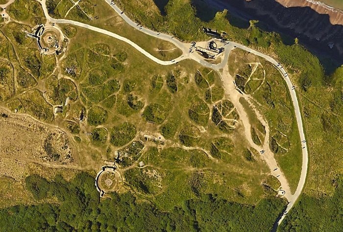 "Preserved craters from the D-Day bombardment of German fortifications at Pointe du Hoc, Normandy."
Image source: imgur.com
"Preserved craters from the D-Day bombardment of German fortifications at Pointe du Hoc, Normandy."
Image source: imgur.com
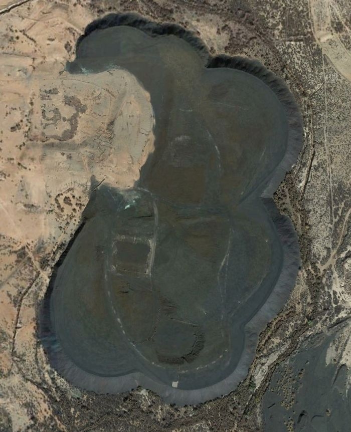 "A huge pile of some black stuff due west of Douglas, Arizona. It looks like a spoil pile from a mine, but I don't see evidence of a mine nearby. Any ideas?"
Image source: imgur.com
"A huge pile of some black stuff due west of Douglas, Arizona. It looks like a spoil pile from a mine, but I don't see evidence of a mine nearby. Any ideas?"
Image source: imgur.com
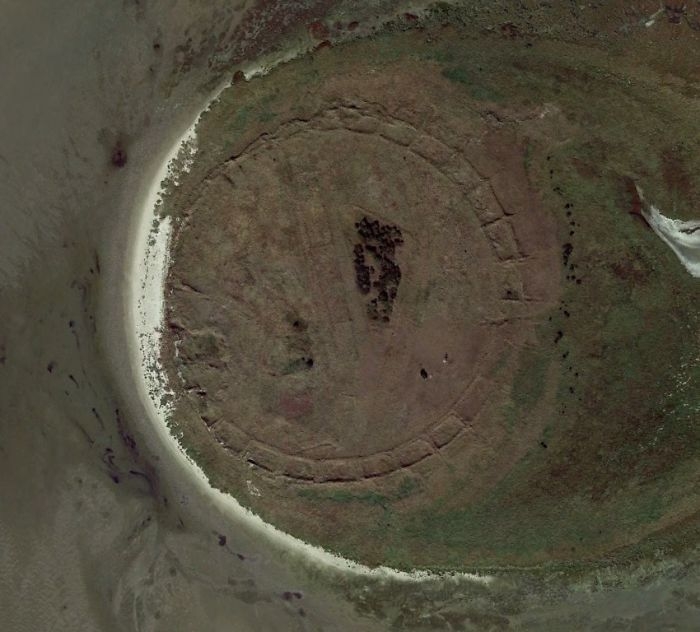 "A very isolated island off the coast of Germany. What's that? My first thought was it had to be ruins from a very old fortification or something. Turns out no. This little island was man made back in 1989. The features were put there to prevent wind erosion."
Image source: imgur.com
"A very isolated island off the coast of Germany. What's that? My first thought was it had to be ruins from a very old fortification or something. Turns out no. This little island was man made back in 1989. The features were put there to prevent wind erosion."
Image source: imgur.com
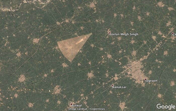 "A strange shaped clearing in the Punjab province of India. I wonder what that is."
Image source: imgur.com
"A strange shaped clearing in the Punjab province of India. I wonder what that is."
Image source: imgur.com
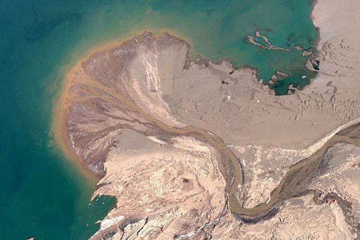 "A cool delta building out into Ayyakum Lake, Tibet. The river is unnamed on Google. It is fed by snowmelt from mountains to the south. You can see some isolated sand dunes NW of the river. There is a name for this type of dune, but I can't remember what it is. They happen when there is enough wind to migrate dunes, but not enough sand."
Image source: imgur.com
"A cool delta building out into Ayyakum Lake, Tibet. The river is unnamed on Google. It is fed by snowmelt from mountains to the south. You can see some isolated sand dunes NW of the river. There is a name for this type of dune, but I can't remember what it is. They happen when there is enough wind to migrate dunes, but not enough sand."
Image source: imgur.com
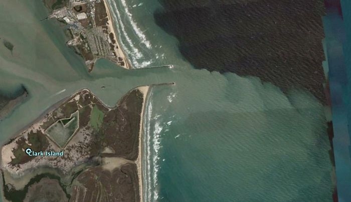 "The Rio Grande River entering the Gulf of Mexico."
Image source: imgur.com
"The Rio Grande River entering the Gulf of Mexico."
Image source: imgur.com
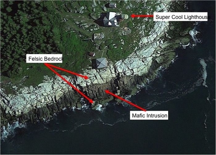 "I cheated a little with this one. I’ve actually been to this place. It’s an island in Penobscot Bay, Maine, USA. We see 2 very distinctive rock bodies contacting one another. My guess is that the darker rock intruded into the lighter rock due to nearby volcanic activity. Nearby Vinalhaven Island is a very old volcano, and the direction kind of fits."
Image source: imgur.com
"I cheated a little with this one. I’ve actually been to this place. It’s an island in Penobscot Bay, Maine, USA. We see 2 very distinctive rock bodies contacting one another. My guess is that the darker rock intruded into the lighter rock due to nearby volcanic activity. Nearby Vinalhaven Island is a very old volcano, and the direction kind of fits."
Image source: imgur.com
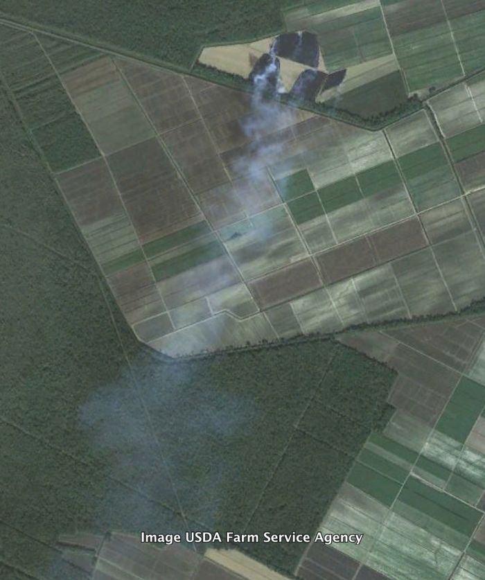 "A sugarcane field burning in south Louisiana, USA. This is commonly done to remove all of the leftovers from harvesting. Sugarcane is a grass so there is a lot of organic material leftover."
Image source: imgur.com
"A sugarcane field burning in south Louisiana, USA. This is commonly done to remove all of the leftovers from harvesting. Sugarcane is a grass so there is a lot of organic material leftover."
Image source: imgur.com
#1
"A beautifully symmetrical volcano on the Kamchatka Peninsula in Russia. Look at those weird red cinder cones on the flanks."
Image source: imgur.com
#2
"This is my favorite. It's a marina near Milwaukee, Wisconsin (USA). The winter ice is in the process of breaking up. I don't know why, but this is very visually appealing to me."
Image source: imgur.com
#3
"USS Arizona and memorial, Pearl Harbor."
Image source: imgur.com
#4
"Underwater tidal channels of the Wadden Sea of Denmark."
Image source: imgur.com
#5
"A breakwater and lighthouse on one of the Great Lakes. I can't remember where. Notice the circular pattern of waves reflecting off the structure."
Image source: imgur.com
#6
"Still the Wadden Sea. Look at that tidal current rippin through there. This one is spooky."
Image source: imgur.com
#7
"Alpine glaciers spilling out spreading across a flat plain. This is in SE Alaska."
Image source: imgur.com
#8
"A volcano in the Great Rift Valley in Tanzania. It's tall enough to have its own, wetter micro climate, hence the green."
Image source: imgur.com
#9
"High vs. low tide on a Normandy beach."
Image source: imgur.com
#10
"SE Alaska, multiple alpine glaciers flowing together."
Image source: imgur.com
#11
"A lonely little gun emplacement that used to guard the entrance to Amsterdam. "
Image source: imgur.com
#12
"These are impact craters in the Canadian Shield, the oldest continental crust of the North American plate. Because it’s been tectonically inactive for a long time and continental glaciers removed most of the topsoil, many craters are visible. This lake is called Lac a l’Eau Claire. There is a lot of evidence that the lake is formed by 2 impact craters. It was originally thought that the 2 impacts were formed at the same time by an asteroid that split or was a binary asteroid. There is some very compelling evidence that these are 2 different impacts, ~200 million years apart. It might seem like a million to one shot that 2 impacts could be so close, but we see many overlapping craters on other planets. The low probability thing for me is that the craters were both preserved and exposed."
Image source: imgur.com
#13
"A push boat and barges stirring up the bottom of the Tombigbee River in Alabama (USA)."
Image source: imgur.com
#14
"A fort in the Netherlands."
Image source: imgur.com
#15
"Above is the coolest delta I've ever seen. It's formed by the William River, which flows through Athabasca Sand Dunes Provincial Park and into Lake Athabasca, Saskatchewan CA. This river has recently become my favorite river, because we share a name. The left side of the image seems to be while the lake is frozen but the river is not. The bands that sort of parallel the shoreline look like cheniers."
Image source: imgur.com
#16
"Another volcano in the Great Rift Valley with a micro climate and a very asymmetrical crater, much like Mt. St. Helens."
Image source: imgur.com
#17
"A beautiful wave-dominated delta in Brazil."
Image source: imgur.com
#18
"Irrigated fields in west Texas. The colors here are awesome. I'm guessing the crops were recently harvested or recently plowed under and we're seeing the soil color. In my experience, harvested corn or wheat fields aren't this orange/red. Any ideas? The white specks are oil pads connected by little roads. This land is certainly being utilized."
Image source: imgur.com
#19
"I read about this one on a forum. I think it's true. The GPS point is the location of the German battleship, Tirpitz when it was sunk by British bombers on 11/12/1944. The Tirpitz was the sister ship of the famous Bismarck. It was also the last serious German surface naval threat. The RAF and Royal Navy played a long cat and mouse game with the Tirpitz as it hid out in Norwegian fjords. It was eventually located and Lancaster bombers attached at high altitude with huge bombs. The 3 round holes (2 in the water, 1 on land) are likely craters from missed bombs. They don't make sense geologically"
Image source: imgur.com
#20
"This is a random place in the Ontario, CA. I think the colors are very nice."
Image source: imgur.com
#21
"An anticline somewhere in Iran with a series of alluvial fans on the south side. I really like the blue color of the formation ringing the center of the anticline. I need to go there and get a sample. You can see the colors of the formations reflected in the fan."
Image source: imgur.com
#22
"After the pretty bad performance of the US in the war of 1812, the federal government realized some things. They needed to maintain a larger, federally controlled, standing army. The states militias were just not up to the task when it came to real war. They also needed to have a larger navy. Privateers weren’t all that great either. Finally, they needed to fortify the border. The royal navy was able to sail all up in our waterways to deploy land forces. Since half of the US border was coastal, this meant lots of coastal forts to shoot at ships. Across the channel is Fort Morgan, a beautiful star fort. I’ve never been to this one, but it looks to be in very good shape. You can see the retrofitting of more modern gun emplacements."
Image source: imgur.com
#23
"Preserved craters from the D-Day bombardment of German fortifications at Pointe du Hoc, Normandy."
Image source: imgur.com
#24
"A huge pile of some black stuff due west of Douglas, Arizona. It looks like a spoil pile from a mine, but I don't see evidence of a mine nearby. Any ideas?"
Image source: imgur.com
#25
"A very isolated island off the coast of Germany. What's that? My first thought was it had to be ruins from a very old fortification or something. Turns out no. This little island was man made back in 1989. The features were put there to prevent wind erosion."
Image source: imgur.com
#26
"A strange shaped clearing in the Punjab province of India. I wonder what that is."
Image source: imgur.com
#27
"A cool delta building out into Ayyakum Lake, Tibet. The river is unnamed on Google. It is fed by snowmelt from mountains to the south. You can see some isolated sand dunes NW of the river. There is a name for this type of dune, but I can't remember what it is. They happen when there is enough wind to migrate dunes, but not enough sand."
Image source: imgur.com
#28
"The Rio Grande River entering the Gulf of Mexico."
Image source: imgur.com
#29
"I cheated a little with this one. I’ve actually been to this place. It’s an island in Penobscot Bay, Maine, USA. We see 2 very distinctive rock bodies contacting one another. My guess is that the darker rock intruded into the lighter rock due to nearby volcanic activity. Nearby Vinalhaven Island is a very old volcano, and the direction kind of fits."
Image source: imgur.com
#30
"A sugarcane field burning in south Louisiana, USA. This is commonly done to remove all of the leftovers from harvesting. Sugarcane is a grass so there is a lot of organic material leftover."
Image source: imgur.comDE
Written by
Demilked Editorial
SaaS Review Specialist · Demilked
With 5+ years in the creator, entertainment, and publishing spaces, Demilked shortlists, reviews, and ranks leading tools that actually make your life easier.