Cartography Group Shares The Most Interesting Maps And Here Are 35 Of The Best Ones
The best maps for fans of geography.
Independently testedUnbiased Demilked scoreFree to implementTools included
Despite the rapid advancements in technology, maps are not fading away; rather, they're evolving in the digital era. They're getting revamped and upgraded, serving new purposes like tracking population density or depicting projections of Earth's future landscapes millions of years ahead.
As a result, the internet is brimming with fascinating and enlightening maps that challenge our perceptions and broaden our understanding of the world. Our team has curated a collection of the most intriguing ones, ready to offer fresh perspectives. Just scroll down to explore!
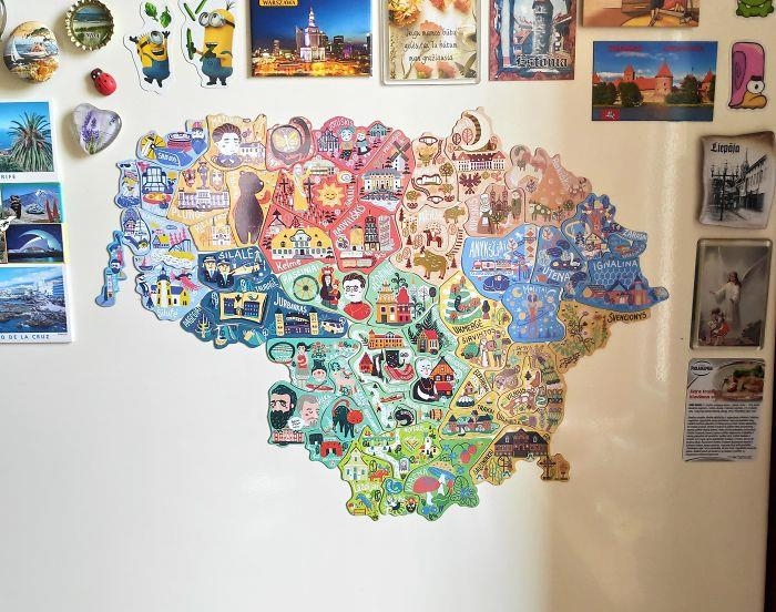 Image source: greycoconut
Blue Morpho Butterfly: ooh, this it totally something i would waste all my money on!
Image source: greycoconut
Blue Morpho Butterfly: ooh, this it totally something i would waste all my money on!
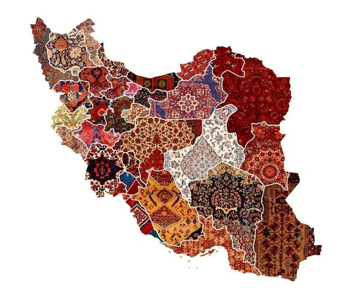 Image source: knownothingwiseguy
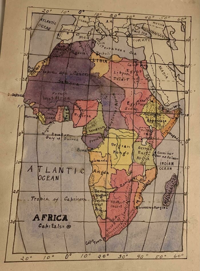 Image source: zherper
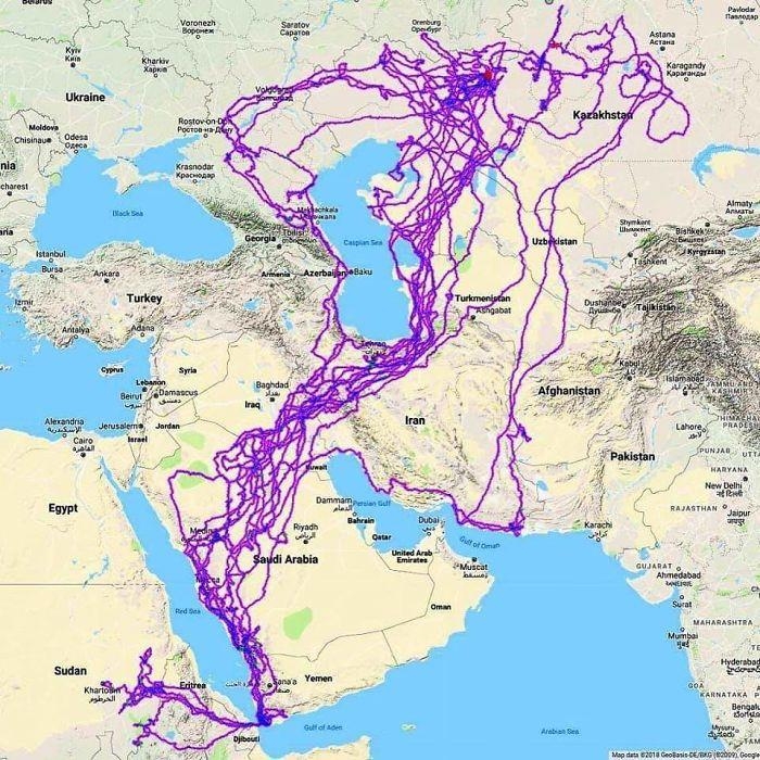 Image source: HDeo950
African Dad: I lived in Afghanistan for a year ~ probably the eagle trying to sound interesting at a party
Image source: HDeo950
African Dad: I lived in Afghanistan for a year ~ probably the eagle trying to sound interesting at a party
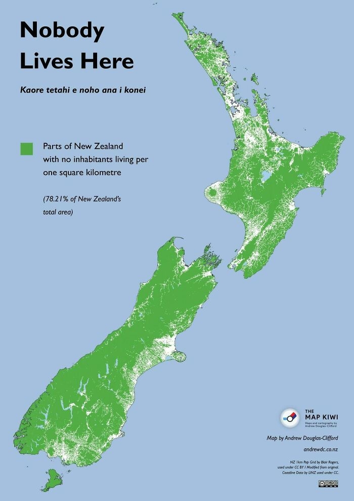 Image source: Felixheifgwofbebrjwh
Nathaniel He/Him Cis-Het: Would not mind going to NZ but I am wary of the Orc problem they had. Has it been sorted? I dislike any racism towards Hobbits.
Image source: Felixheifgwofbebrjwh
Nathaniel He/Him Cis-Het: Would not mind going to NZ but I am wary of the Orc problem they had. Has it been sorted? I dislike any racism towards Hobbits.
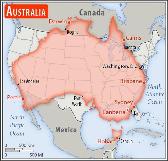 Image source: AJgloe
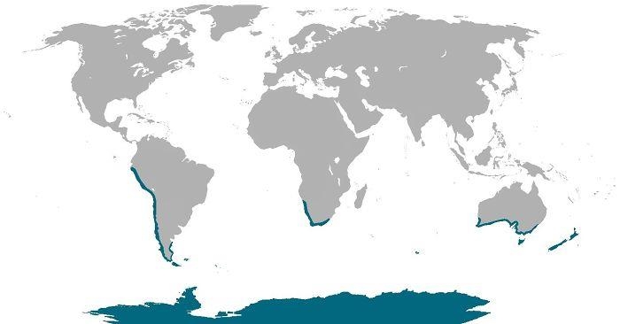 Image source: cheeseface35
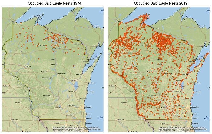 Image source: zstahowiak
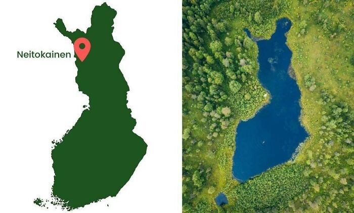 Image source: Inutilmono
Bouche and Audi and Shyla, Oh My!: Finception.
Image source: Inutilmono
Bouche and Audi and Shyla, Oh My!: Finception.
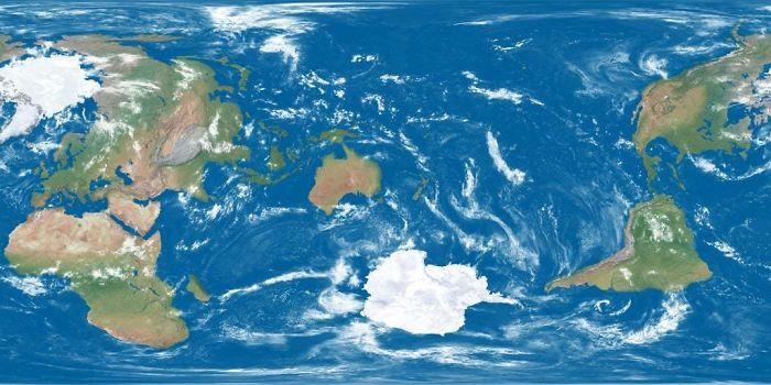 Image source: ParadoxicalCabbage
LeMurierBonjour: It is arbitrary but it is also the line for Greenwich Mean Time on which longitude and World time zones are based.
Image source: ParadoxicalCabbage
LeMurierBonjour: It is arbitrary but it is also the line for Greenwich Mean Time on which longitude and World time zones are based.
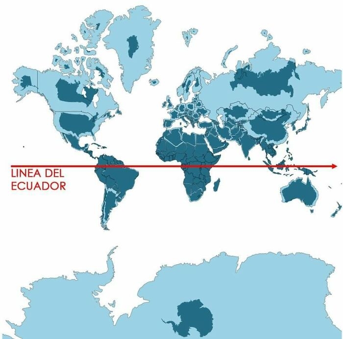 Image source: aisbosseth
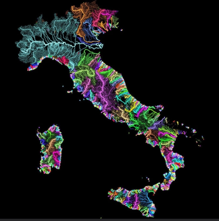 Image source: JoeFalchetto
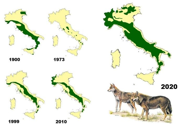 Image source: Risingmagpie
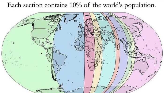 Image source: AppleBiryani
Gabriel: For those confused, because I was for a hot minute, the smaller the sliver, the denser the population. I think?
Image source: AppleBiryani
Gabriel: For those confused, because I was for a hot minute, the smaller the sliver, the denser the population. I think?
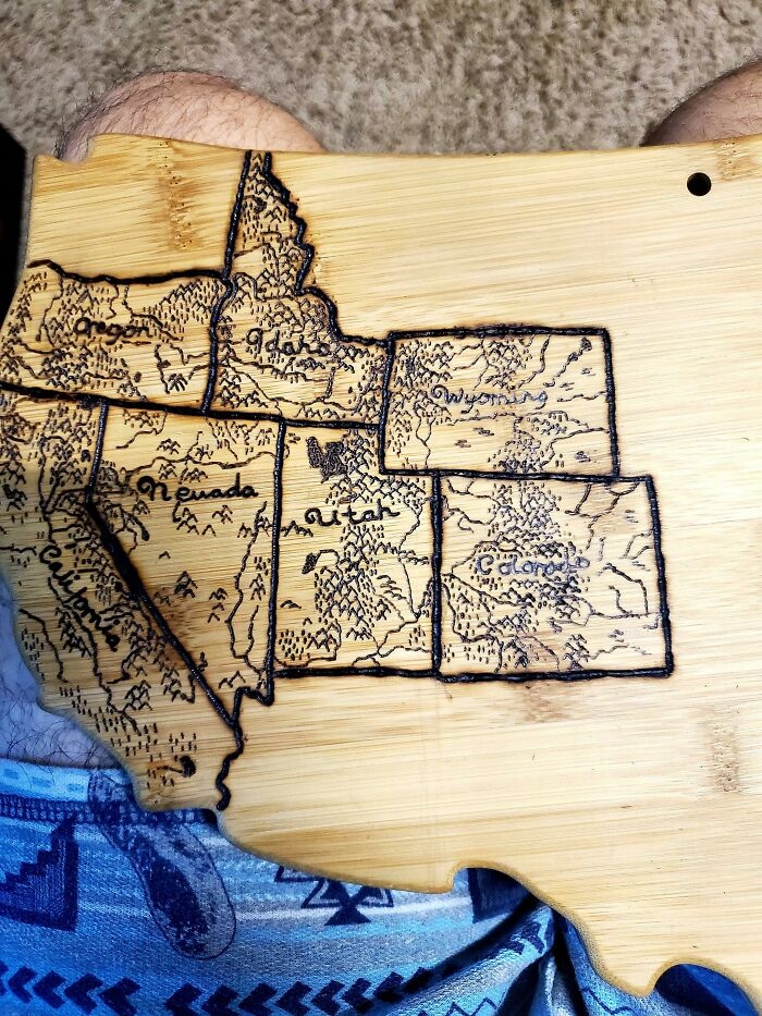 Image source: Doofinx
We get married next Sunday. I used a woodburning kit to burn a map of all the states we have visited as a couple. We both love to travel and backpack do I want to to keep adding to it as we get older.
Image source: Doofinx
We get married next Sunday. I used a woodburning kit to burn a map of all the states we have visited as a couple. We both love to travel and backpack do I want to to keep adding to it as we get older.
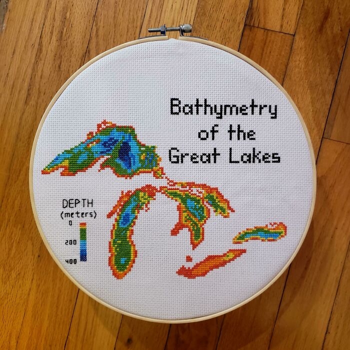 Image source: blondeboxshell
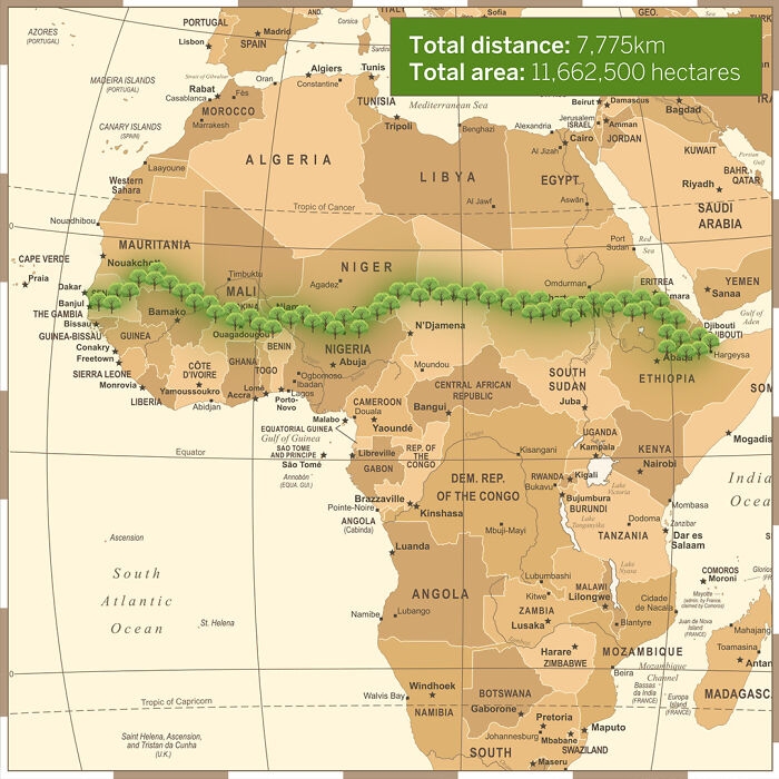 Image source: InkyScrolls
The African Union is leading an initiative to plant the Great Green Wall, a 7,775 km (4,830 mi) belt of trees crossing the entire breadth of north Africa.
Image source: InkyScrolls
The African Union is leading an initiative to plant the Great Green Wall, a 7,775 km (4,830 mi) belt of trees crossing the entire breadth of north Africa.
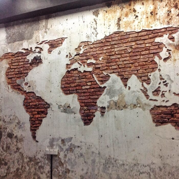 Image source: eveildancer
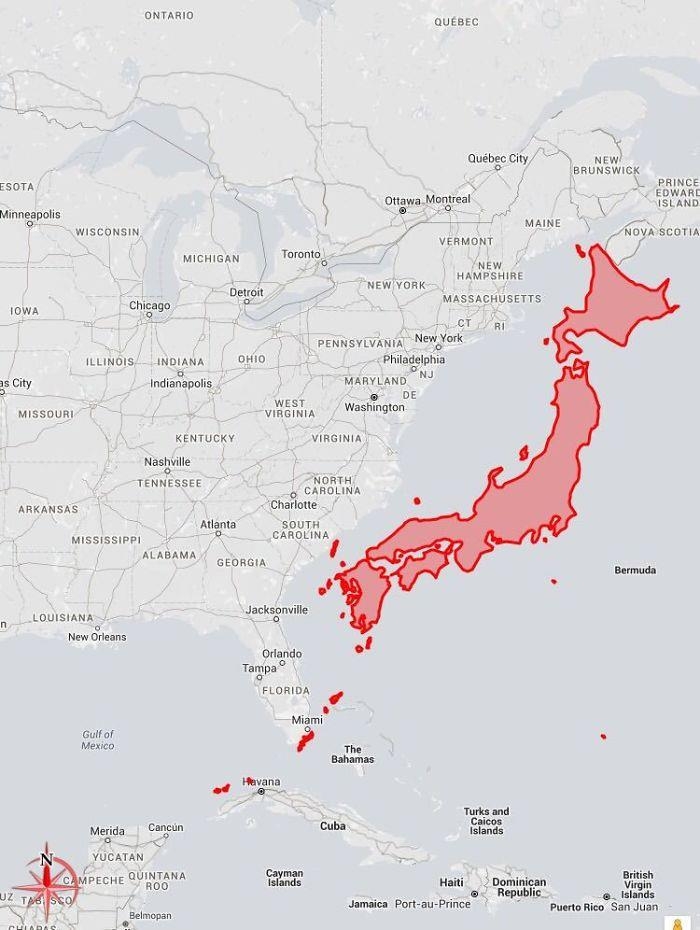 Image source: c0urso
Sue Denham: Still not clear. Maybe show us some bananas for, you know, scale?
Image source: c0urso
Sue Denham: Still not clear. Maybe show us some bananas for, you know, scale?
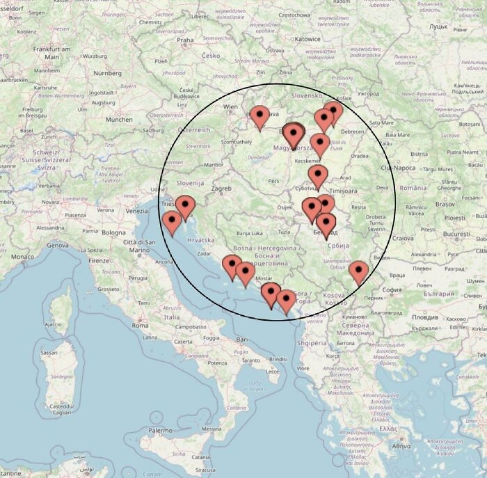 Image source: ASR004
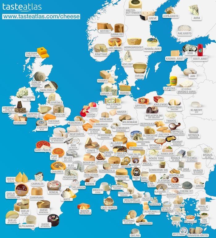 Image source: dazzledvulture
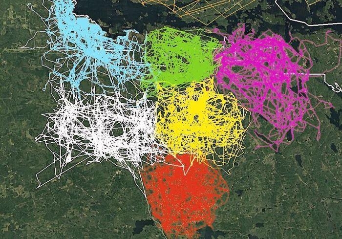 Image source: john3806
LakotaWolf (she/her): We have observed humans long enough to know that, when groups cross over, disagreements and politics happen XD
Image source: john3806
LakotaWolf (she/her): We have observed humans long enough to know that, when groups cross over, disagreements and politics happen XD
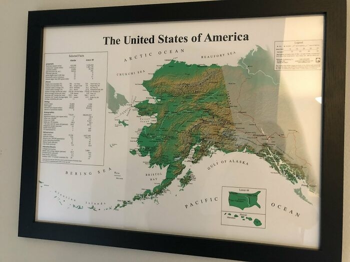 Image source: Pariahdog119
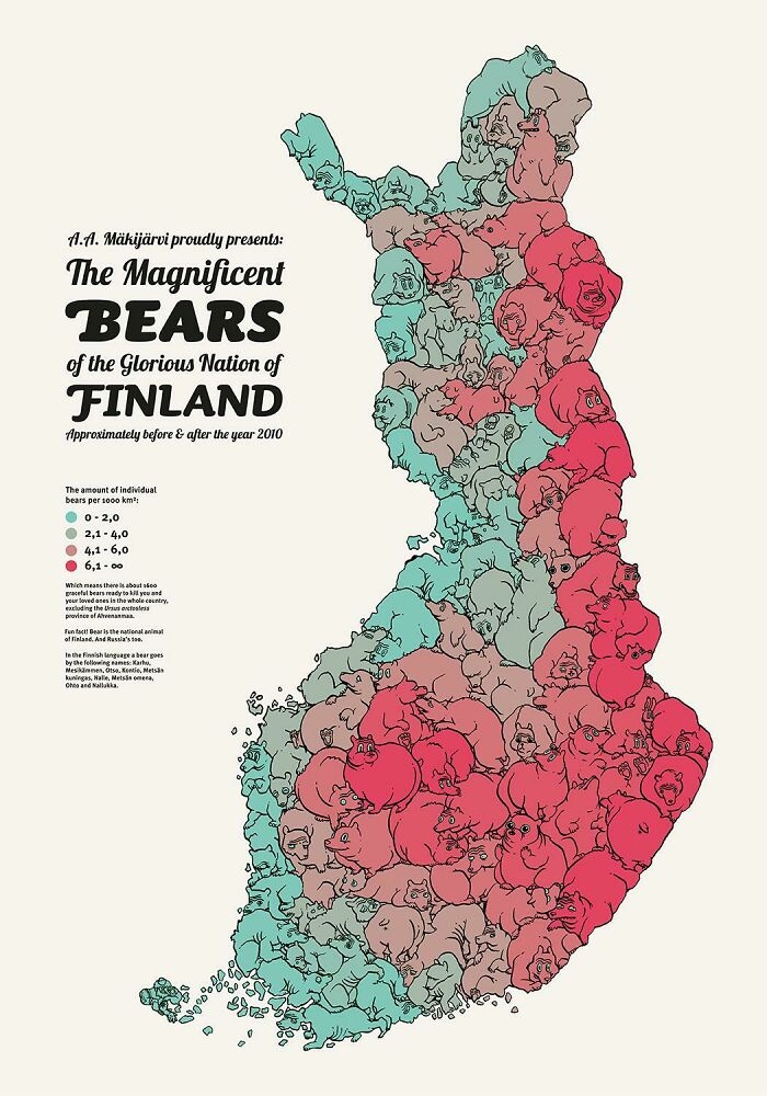 Image source: Asmodeane
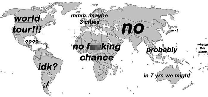 Image source: esloubro
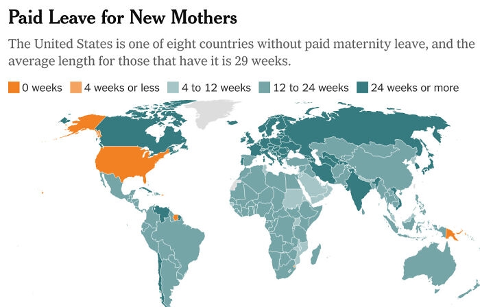 Image source: No_Negotiation_7176
Slapdash1: The greatest third world country in the world lol
Image source: No_Negotiation_7176
Slapdash1: The greatest third world country in the world lol
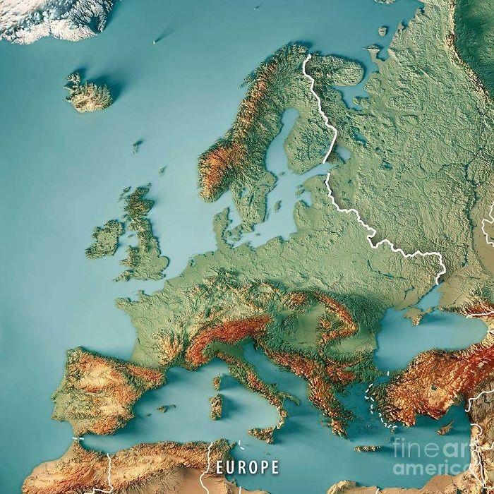 Image source: reddit.com
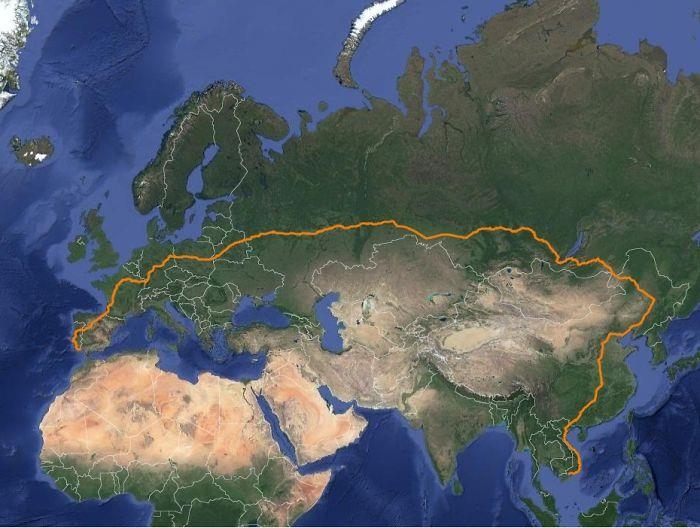 Image source: matias90
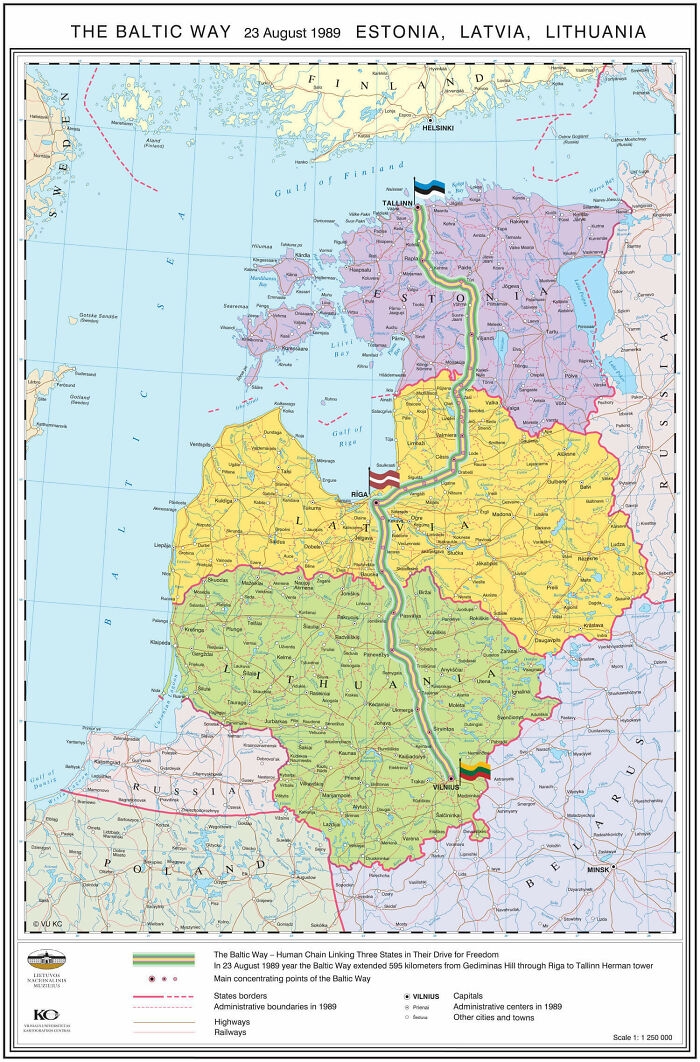 Image source: SteO153
The protest was against the Soviet occupation, and to support the independence movements of the three States (2014).
Image source: SteO153
The protest was against the Soviet occupation, and to support the independence movements of the three States (2014).
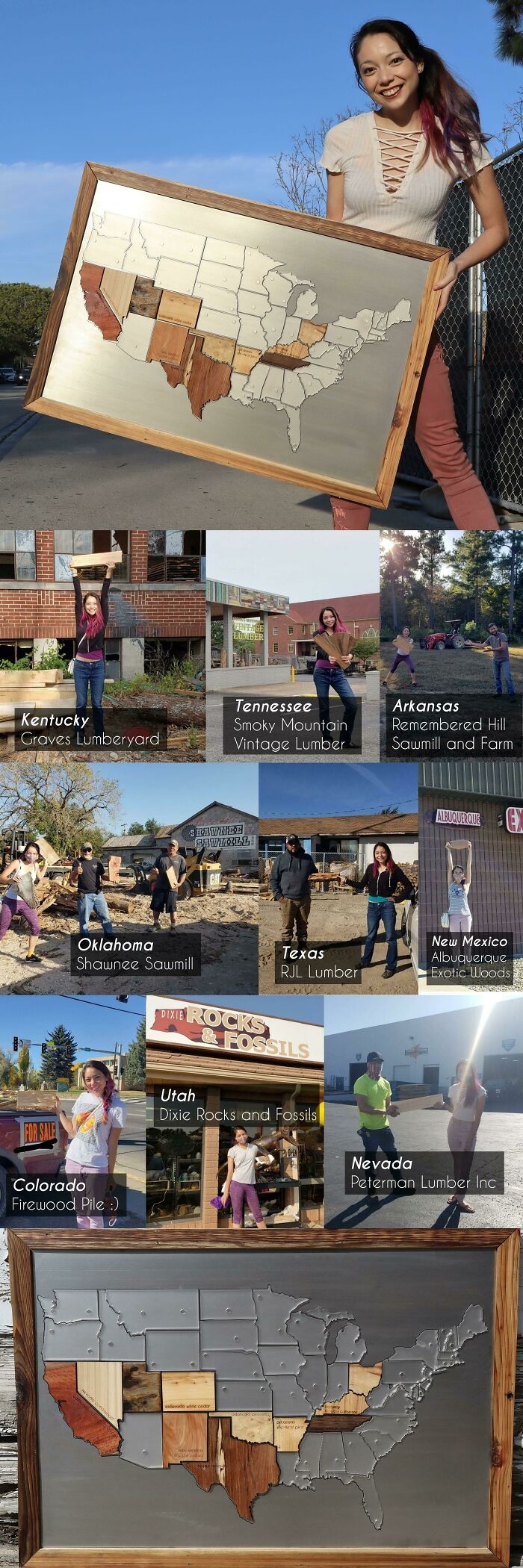 Image source: Physical-Order
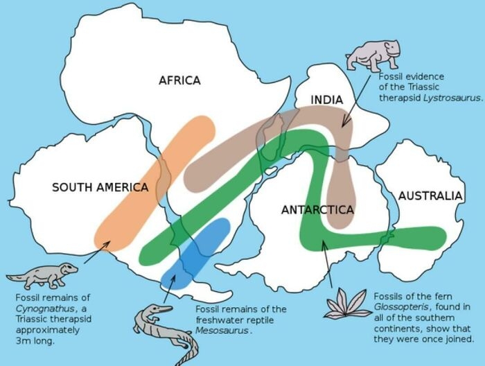 Image source: No_Woodpecker259
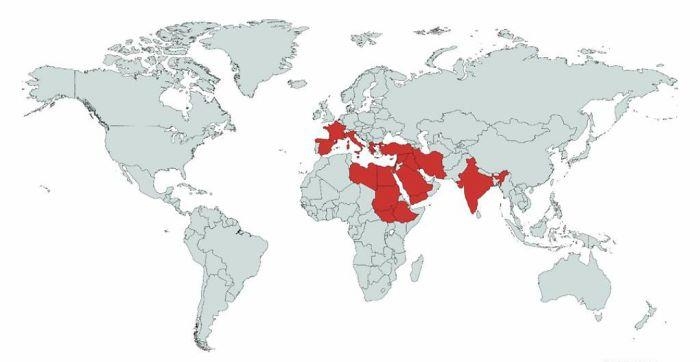 Image source: Erik_John09
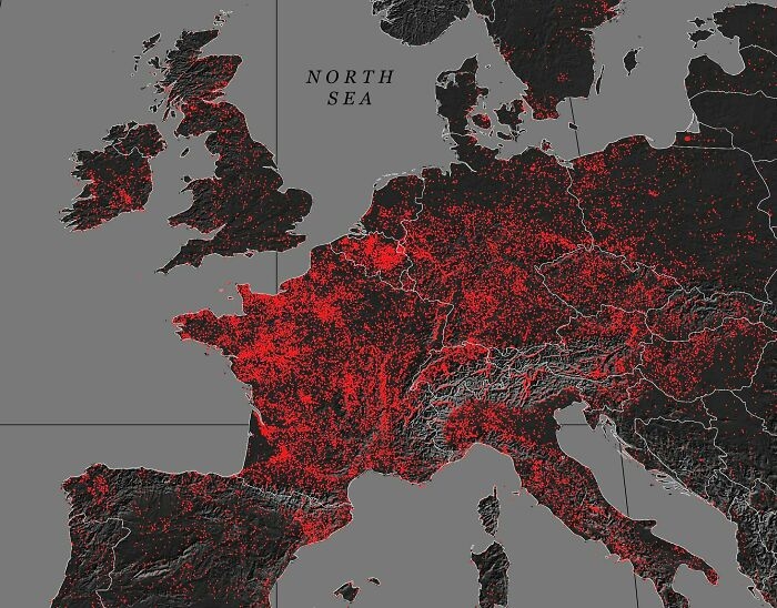 Image source: MardukSyria
PFD: Could do with some kind of context/ definitions here. It's usually said that Germany has the greatest number and Wales the highest concentration of castles in Europe.
Image source: MardukSyria
PFD: Could do with some kind of context/ definitions here. It's usually said that Germany has the greatest number and Wales the highest concentration of castles in Europe.
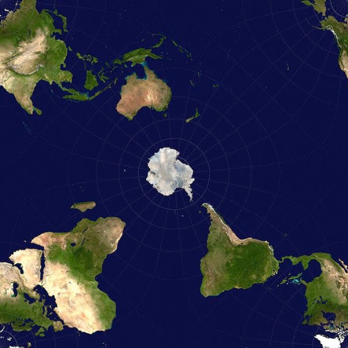 Image source: axeman_05
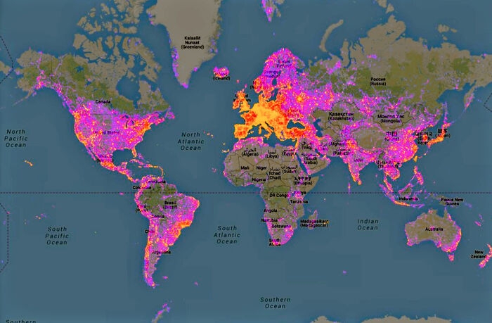 Image source: the-70s-kid
HI, I'M A SHOUTY MAN: I love how there's this little hotspot in the middle of Aus for Uluru! Like the rest of it is just mainly empty and then bam that's cool. My area also looks pretty hot
Image source: the-70s-kid
HI, I'M A SHOUTY MAN: I love how there's this little hotspot in the middle of Aus for Uluru! Like the rest of it is just mainly empty and then bam that's cool. My area also looks pretty hot
#1 To Increase Local Tourism, Lithuania Has Made A Map With Magnets That You Can Only Find In Corresponding Cities
Image source: greycoconut
Blue Morpho Butterfly: ooh, this it totally something i would waste all my money on!
#2 Map Of Regional Rug Patterns Of Iran
Image source: knownothingwiseguy
#3 My Great Grandpa Drew This Map Of Africa In The 1910’s. Thought You All Might Like It
Image source: zherper
#4 Tracking Of An Eagle Over A 20 Year Period
Image source: HDeo950
African Dad: I lived in Afghanistan for a year ~ probably the eagle trying to sound interesting at a party
#5 No One Lives In The Green Part Of New Zealand,the Population Density There Is 0 People Per Km And That Is About 78% Of New Zealand Land
Image source: Felixheifgwofbebrjwh
Nathaniel He/Him Cis-Het: Would not mind going to NZ but I am wary of the Orc problem they had. Has it been sorted? I dislike any racism towards Hobbits.
#6 Size Comparison Between Australia And The United States
Image source: AJgloe
#7 Where Penguins Are Found Naturally In The World
Image source: cheeseface35
#8 Occupied Bald Eagle Nests In Wisconsin. 1974 vs. 2019. Growth Credited To The Clean Water Act
Image source: zstahowiak
#9 There Is A Lake In Finland, That Looks Like Finland
Image source: Inutilmono
Bouche and Audi and Shyla, Oh My!: Finception.
#10 The Earth Being Centered On Great Britain Is Arbitrary, So Here's A Map Centered On New Zealand
Image source: ParadoxicalCabbage
LeMurierBonjour: It is arbitrary but it is also the line for Greenwich Mean Time on which longitude and World time zones are based.
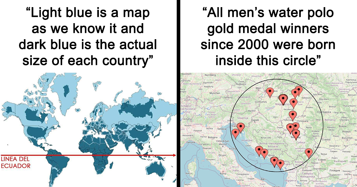
#11 Light Blue Is A Map As We Know It And Dark Blue Is The Actual Size Of Each Country
Image source: aisbosseth
#12 Rivers Of Italy
Image source: JoeFalchetto
#13 Wolf Distribution In Italy From 1900 To 2020
Image source: Risingmagpie
#14 Each Section Has 10% Of The World's Population
Image source: AppleBiryani
Gabriel: For those confused, because I was for a hot minute, the smaller the sliver, the denser the population. I think?
#15 This Is My Wedding Gift To My Wife
Image source: Doofinx
We get married next Sunday. I used a woodburning kit to burn a map of all the states we have visited as a couple. We both love to travel and backpack do I want to to keep adding to it as we get older.
#16 Hello! I Cross Stitch Earth Science Maps And Have Been Told They Belong Here. Great Lakes Bathymetry Is My Favorite So Far
Image source: blondeboxshell
#17 To Combat The Threat Of Desertification Of The Sahel (The Region Immediately To The South Of The Sahara)
Image source: InkyScrolls
The African Union is leading an initiative to plant the Great Green Wall, a 7,775 km (4,830 mi) belt of trees crossing the entire breadth of north Africa.
#18 World Map Mural
Image source: eveildancer
#19 Japan, How Big It Is In Reality?
Image source: c0urso
Sue Denham: Still not clear. Maybe show us some bananas for, you know, scale?
#20 After Tokyo 2020 This Map Remains The Same. All Men’s Water Polo Gold Medal Winners Since 2000 Were Born Inside This Circle
Image source: ASR004
#21 Cheese Map Of Europe
Image source: dazzledvulture
#22 An Image Of GPS Tracking Of Multiple Wolves In Six Different Packs Around Voyageurs National Park Shows How Much The Wolf Packs Avoid Each Other's Range
Image source: john3806
LakotaWolf (she/her): We have observed humans long enough to know that, when groups cross over, disagreements and politics happen XD
#23 The United States Of America: Alaskan Perspective
Image source: Pariahdog119
#24 A Map Of Finland's Bear Population, Made Up Of Bears
Image source: Asmodeane
#25 When A Band Announces A World Tour
Image source: esloubro
#26 Countries Which Offer Paid Maternity Leave And The Time They Provide For Expecting Mothers
Image source: No_Negotiation_7176
Slapdash1: The greatest third world country in the world lol
#27 3D Render Topographic Map Of Europe
Image source: reddit.com
#28 The Longest Possible Train Travel In The World
Image source: matias90
#29 The Baltic Way. On 23 August 1989, Two Million People Joined Their Hands To Form A Human Chain Spanning 675.5 Km Across The Three Baltic States
Image source: SteO153
The protest was against the Soviet occupation, and to support the independence movements of the three States (2014).
#30 This Is Awesome
Image source: Physical-Order
#31 Existence Of Pangaea Proven With Evidence Of Similar Fossils Across Continents
Image source: No_Woodpecker259
#32 List Of Countries Mentioned Or Referred In The Bible
Image source: Erik_John09
#33 Concentration Of Castles In Europe
Image source: MardukSyria
PFD: Could do with some kind of context/ definitions here. It's usually said that Germany has the greatest number and Wales the highest concentration of castles in Europe.
#34 World Map Cantered On Antarctica
Image source: axeman_05
#35 Map Of Most Photographed Places In The World
Image source: the-70s-kid
HI, I'M A SHOUTY MAN: I love how there's this little hotspot in the middle of Aus for Uluru! Like the rest of it is just mainly empty and then bam that's cool. My area also looks pretty hotDE
Written by
Demilked Editorial
SaaS Review Specialist · Demilked
With 5+ years in the creator, entertainment, and publishing spaces, Demilked shortlists, reviews, and ranks leading tools that actually make your life easier.